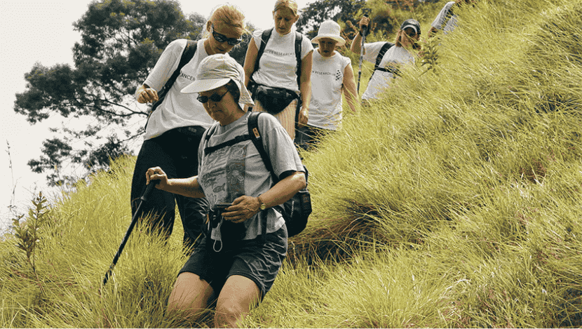
A UNESCO Biosphere Reserve, Sinharaja is the last surviving primary rainforest of Sri Lanka. Trekking here is stepping into a living library of biodiversity: endemic birds flashing in the canopy, rare orchids blooming in the mist, and streams weaving through emerald undergrowth. Globeenjoy organizes guided treks led by local naturalists, ensuring that trails are respected and communities are supported.
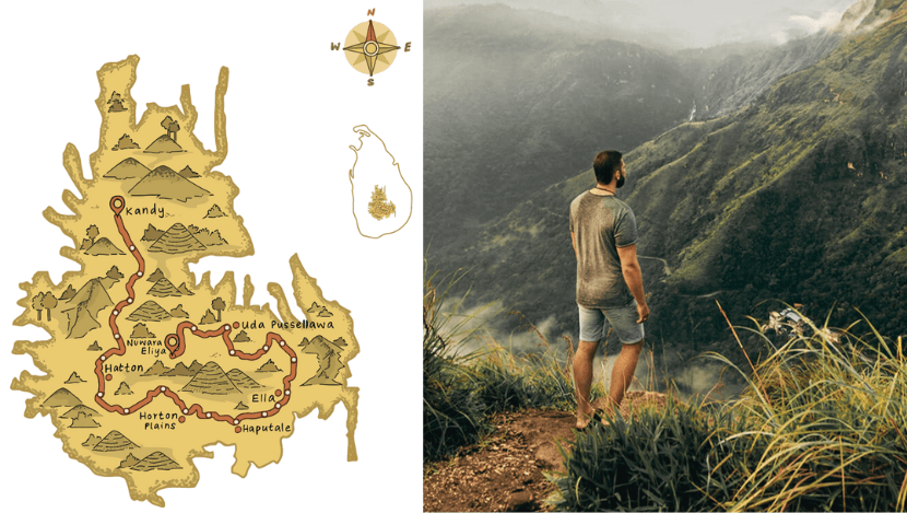
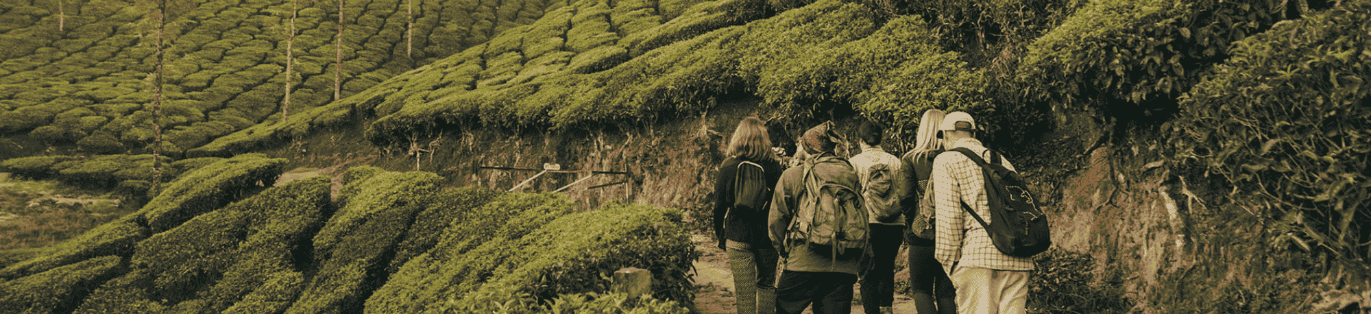
Length and Structure: The Pekoe Trail spans approximately 300 kilometres (≈186 miles). It is divided into 22 stages ranging from about 8 km to 19 km each.
Route: The route begins near Kandy (at Hanthana / Ceylon Tea Museum area) and winds south through the hill country, tea estates, forest reserves, viewpoints, villages, ending near Pedro Estate in Nuwara Eliya.
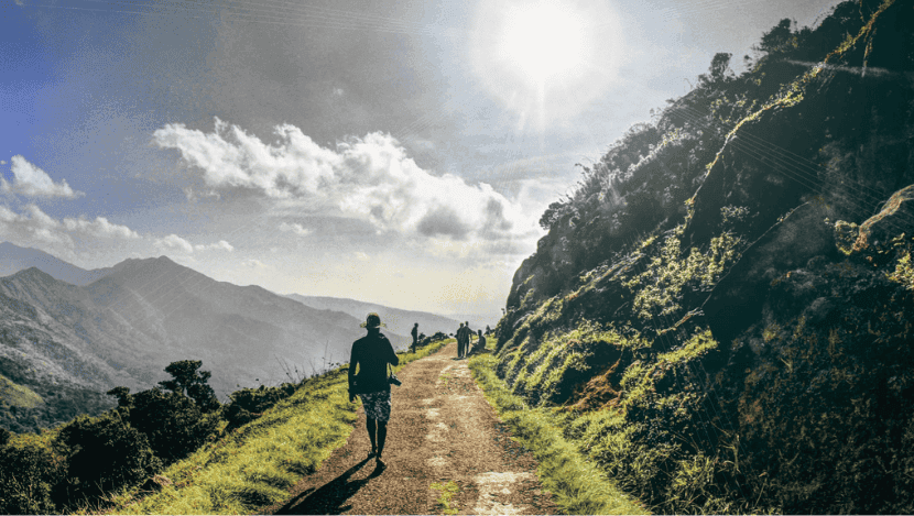
Elevation & Terrain: You'll pass through altitudes with climbs and descents, walking through tea garden roads, estate tracks, forested sections, old colonial roads, ridges, ridgelines, and sometimes steep slopes. Some stages are more challenging, others more moderate.
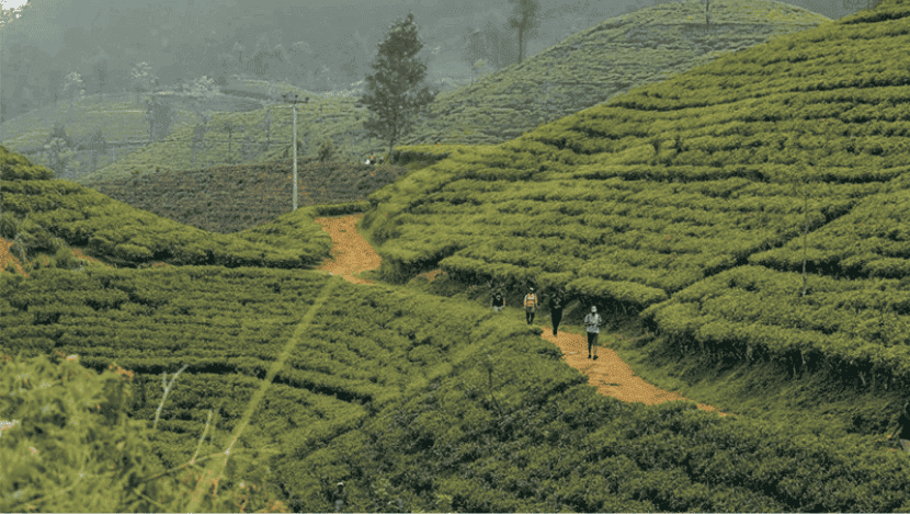
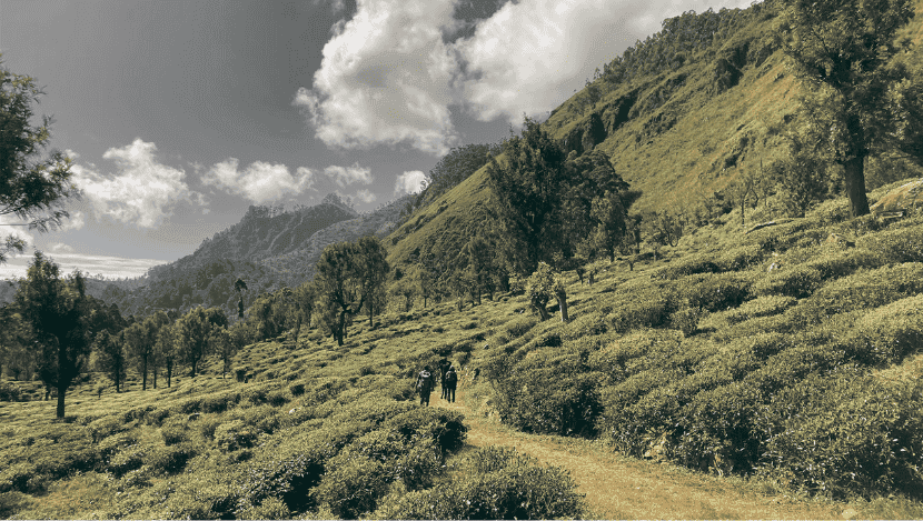
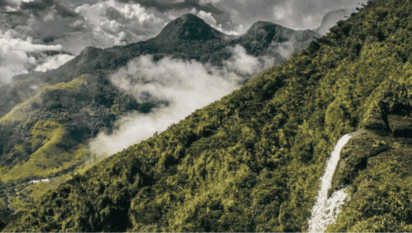
Spectacular Tea Country Landscapes: Rolling hills carpeted with tea, fog and mist drifting among the slopes, vibrant green terraces, and lush plantations with panoramic views.
Changing Ecosystems: From higher montane cloud forests (fog, moss, ferns) to valleys, rivers, waterfalls, village farmland, glimpses of forest reserves. Diversity of flora & fauna along the way.
Local Culture & Tea Heritage: The trail passes through estate worker villages, old estate bungalows, factories, colonial histories, paths used by generations of tea pluckers (many of Indian Tamil origin). Interaction with locals is integral. You see the real working tea estates, not just photo-spots.
Historical Roads & Hidden Routes: You will walk along old cart roads and colonial estate pathways (for example Dimbula Road in Stage 3), often long forgotten, now restored to facilitate hiking.
How to Do It:
You can walk the entire Pekoe Trail over many days (staying in guesthouses, homestays, or eco-lodges along the route),
or choose shorter sections near towns (e.g. around Ella, Haputale, Kandy) if you have less time.
Accommodation & Food: There are guesthouses, small hotels, and homestays at ends of many sections. But in more remote stages, options are limited—book ahead. It’s wise to confirm lodging availability, and carry some snacks or water for more isolated stretches.
Navigation & Support:
Use the official Pekoe Trail app, or apps like AllTrails or Wikiloc, for maps, trail passes, updates, and navigation.
Trail signage has been installed in many stages. In some parts, trails may be less marked, carry a map and follow local advice.
Permits or Fees: Currently the trail is free to hike, but plans are underway for a trail pass (maybe ~US$10 per person per stage) to help fund maintenance. Use of passes is expected to be on an honesty basis.
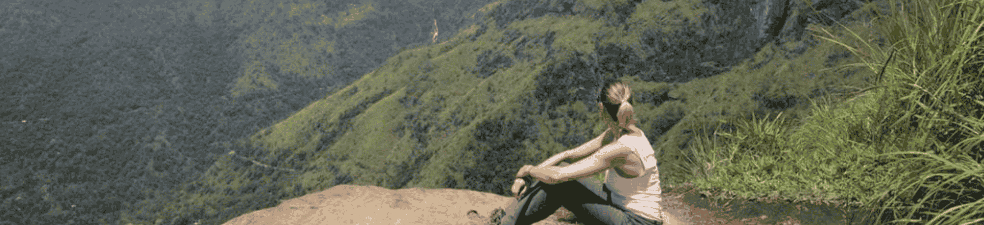
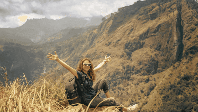
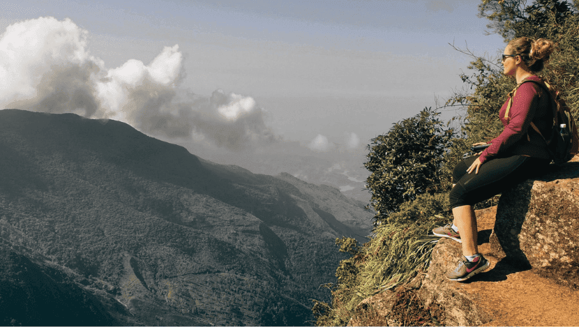
Authentic & Off the Beaten Path Experience: Unlike busy cultural heritage sites, the Pekoe Trail offers solitude, discovery, nature and culture without heavy crowds. You connect more deeply with people, land, tea heritage.
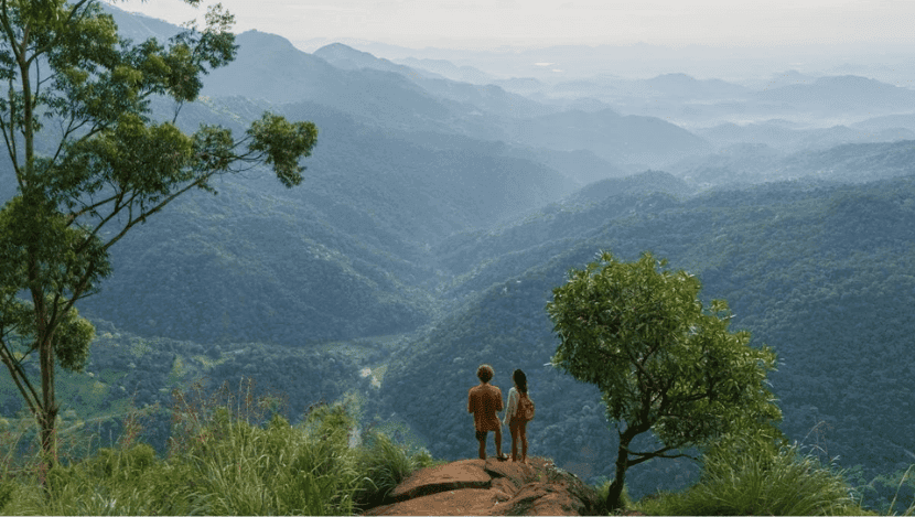
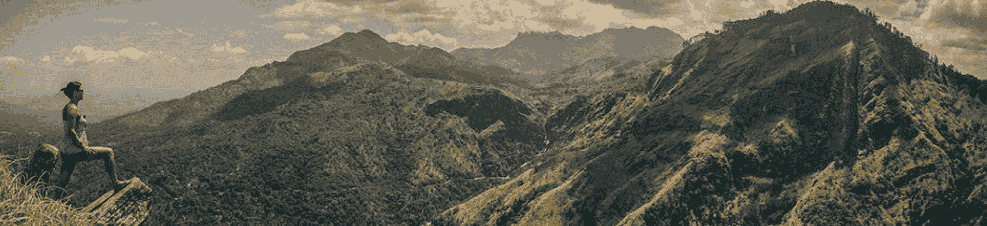
Diversity of Scenery & Physical Challenge: Each stage offers different landscapes—every day may bring new vistas: misty peaks, waterfalls, forest canopies, rivers, ridges, plantations. It satisfies both casual hikers and seasoned trekkers.
Tea & Culture Immersion: If you love tea, history, colonial architecture, and local traditions, this trail brings you close to the working tea industry—tea factories, plantations, and estates where generations have lived.
Support for Sustainable & Responsible Travel: Walking the Pekoe Trail supports local economies, conservation, cultural preservation. It embodies eco-tourism – low impact, high reward.
Trail’s Prestige & Global Recognition: Already recognized by outlets like National Geographic, Time’s World’s Greatest Places, and others for its natural beauty and sustainable model. Visiting it puts you on a rising, well-curated hiking path.
The Knuckles Mountain Range, named for its resemblance to a clenched fist when viewed from certain angles, is one of Sri Lanka’s most breathtaking and bio-diverse landscapes. Recognized as part of the Central Highlands UNESCO World Heritage Site, this mountain wilderness offers a blend of natural beauty, rare wildlife, ancient villages, and hiking adventures that make it one of the island’s must-visit eco-destinations.
The Knuckles are part of the Central Highlands of Sri Lanka, inscribed by UNESCO in 2010. This recognition comes from its:
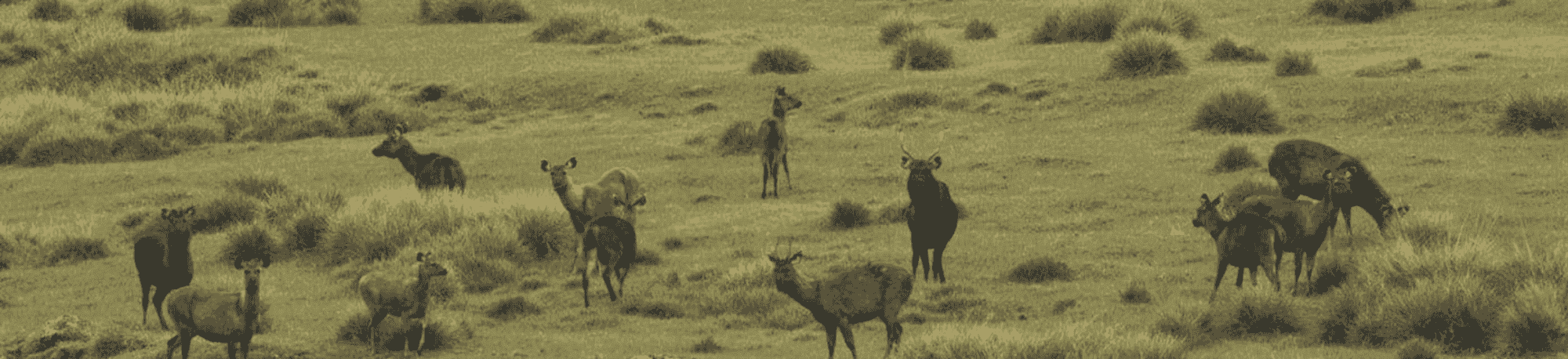
High Biodiversity: Over 34% of Sri Lanka’s endemic flora and fauna can be found here.
Endemic Species: Unique reptiles, amphibians, and birds thrive only in these cloud forests.
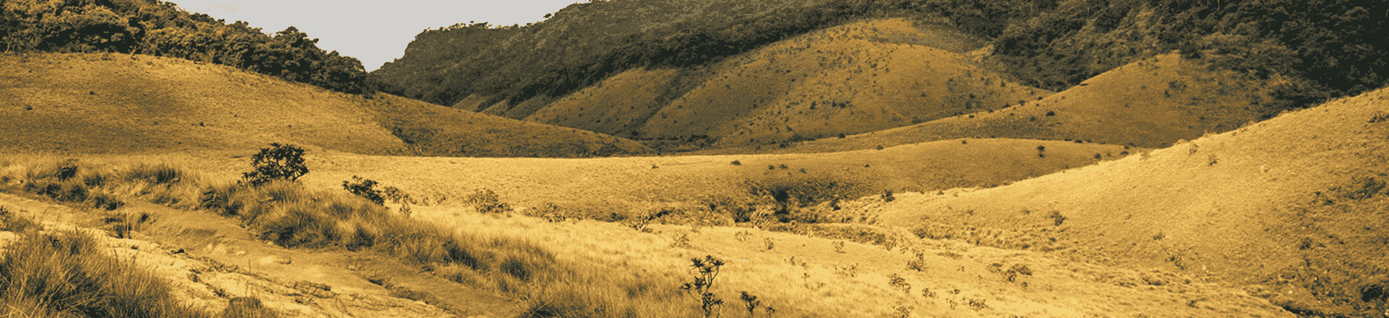
Rare Ecosystems: Includes montane cloud forests, pygmy forests, savanna grasslands, waterfalls, and rivers.
Cultural Heritage: Ancient villages within the range still preserve traditional farming, paddy fields, and rituals, unchanged for centuries.
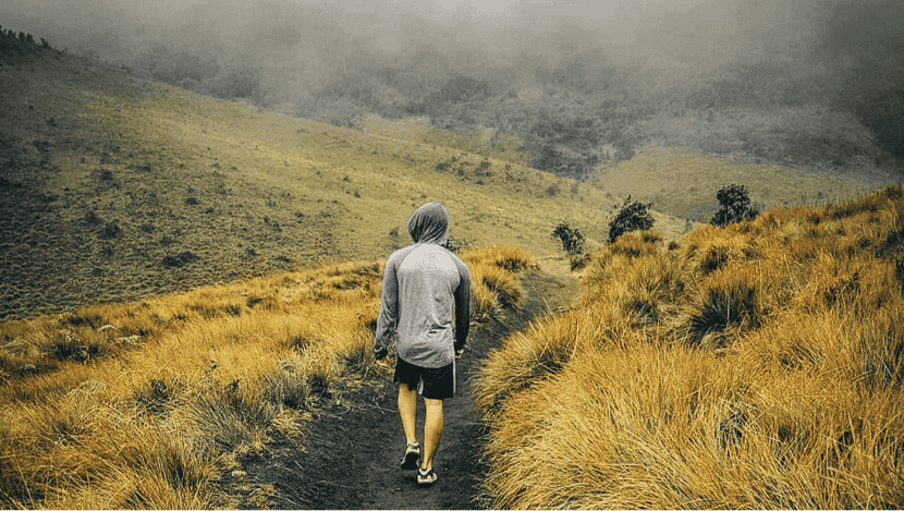
Misty Forest Trails: Walk through moss-covered forests, bamboo groves, and fern-lined paths.
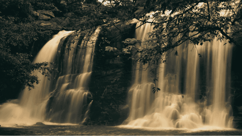
Waterfalls & Streams: The range is the source of major rivers like the Mahaweli; hikers will encounter countless streams and hidden cascades.
Scenic Views: On clear days, panoramic vistas stretch from the hill country to the lowlands, sometimes even as far as Trincomalee’s coast.
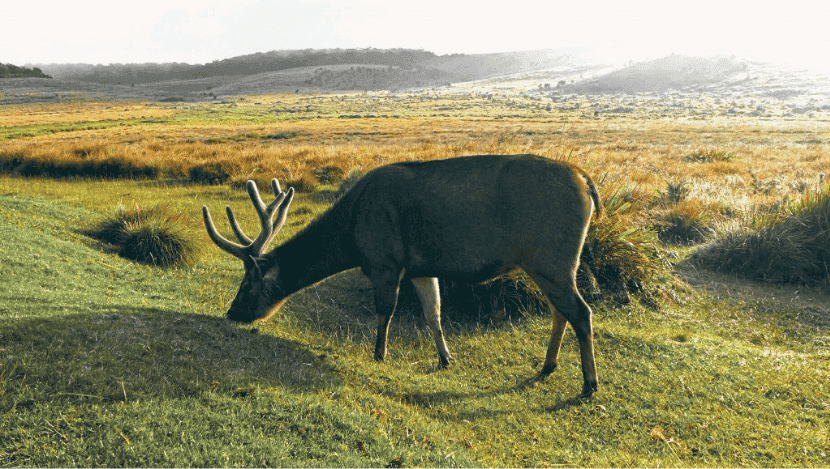
Flora & Fauna: Orchids, medicinal plants, cloud forest trees, and wildlife like purple-faced leaf monkeys, barking deer, and endemic bird species including the Sri Lanka bush warbler.
Best time: December to April (dry season with clearer skies).
Avoid: October–November (monsoon season with heavy rains).
May to September: Possible but expect occasional rain and mist.
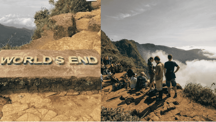
Perched high in Sri Lanka’s central highlands at an altitude of over 2,100 meters, Horton Plains National Park is one of the island’s most enchanting landscapes. This UNESCO World Heritage Site forms part of the Central Highlands of Sri Lanka and is best known for its unique montane ecosystem, rare wildlife, and the breathtaking viewpoint of World’s End, where the plateau suddenly plunges nearly 880 meters to the lowlands below. A visit to Horton Plains is not just a hike, it is a journey through pristine wilderness, mystical cloud forests, and sweeping grasslands that few places in the tropics can offer.
World’s End: The park’s most famous feature, a dramatic escarpment where the land drops sharply by nearly 880 meters, offering panoramic views that, on clear mornings, stretch all the way to the southern coastline.
Mini World’s End: A smaller, yet still spectacular viewpoint with a 270-meter drop, easier to access for less experienced hikers.
The hike to World’s End is best done at sunrise, as mist often blankets the view later in the morning.
Baker’s Falls: A beautiful waterfall named after British explorer Sir Samuel Baker, reached via a forested trail.
Kirigalpoththa Mountain (2,388 m): The second-highest peak in Sri Lanka, accessible through a challenging hike starting in the park.
Thotupola Kanda (2,357 m): The third-highest peak, with a relatively moderate climb, rewarding trekkers with panoramic views.
Main Circular Trail: The most popular trek is a 9.5 km loop (taking 3–4 hours), passing through grasslands, forests, World’s End, Mini World’s End, and Baker’s Falls.
Difficulty Level: Moderate—suitable for most travelers with average fitness. Trails are well-marked but can be slippery in wet weather.
Altitude: The cool climate (average 16°C, dropping to near 0°C at night) makes hiking comfortable compared to lowland heat.
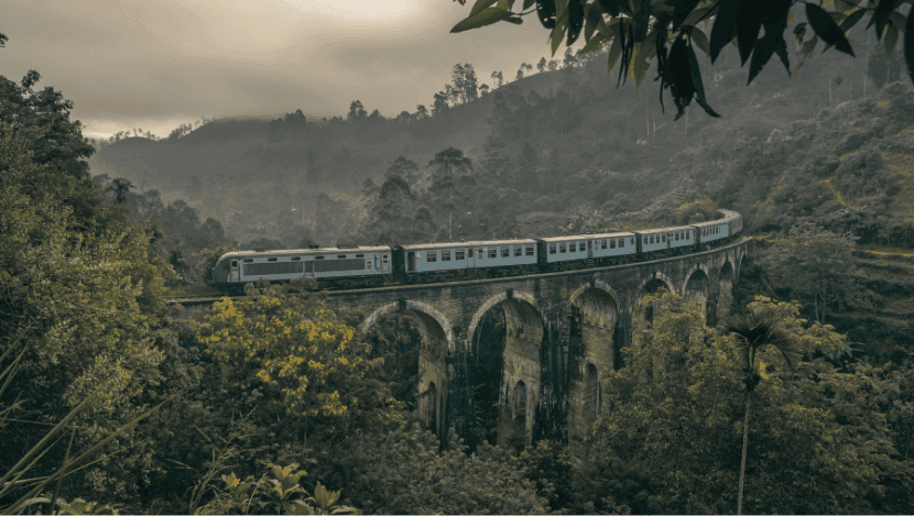
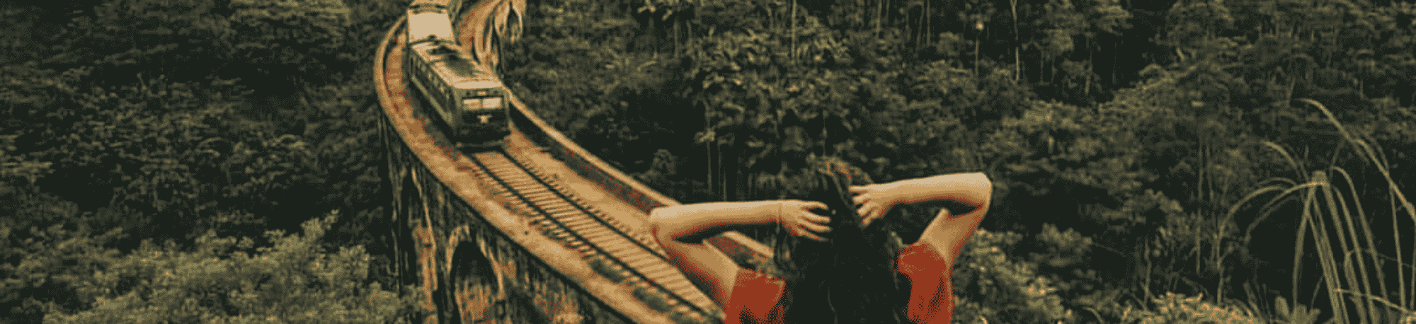
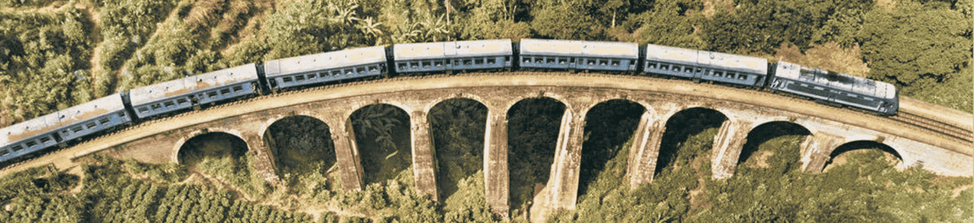
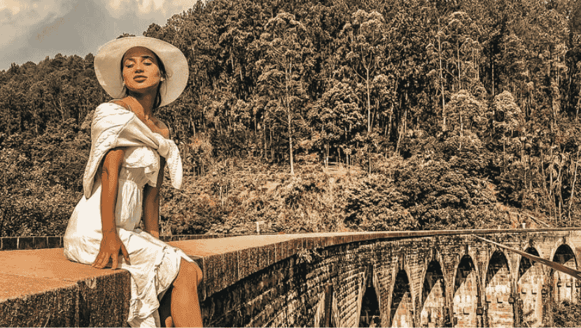
Nestled in the lush hills of Ella, the Nine Arches Bridge, also known as the Bridge in the Sky, is one of Sri Lanka’s most photographed landmarks and a highlight for every traveler to the hill country. Built during the British colonial period, this stone railway bridge blends engineering genius with breathtaking scenery, making it a must-visit on any Sri Lankan journey.
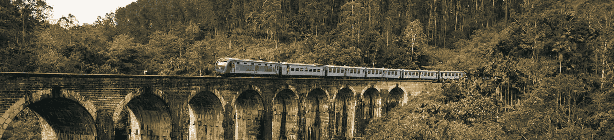
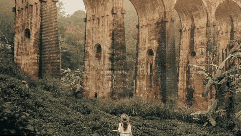
The Nine Arches Bridge is located just 2 km from Ella town, making it an easy half-day adventure.
Walking Route
Start from Ella town and follow the road towards the bridge through tea plantations and village paths.
The walk takes about 20–30 minutes from town, longer if you stop for photos.
Along the way, you’ll pass homestays, tea shops, and friendly locals.
Other Access Points
By tuk-tuk: A quick and affordable ride from Ella to the trailhead, followed by a short walk.
From Demodara station: A longer, scenic railway walk that takes you directly over the bridge.
What sets Globeenjoy apart is not just the destinations, but the philosophy behind them. Every wildlife safari is guided with conservation ethics. Every hike employs local guides who know the land intimately. Every Eco-lodge chosen reduces plastic, embraces solar energy, and supports village livelihoods. Wildlife and nature are not backdrops for tourism, they are living treasures, entrusted to us with care. Guests are not passive spectators but conscious travellers, part of a new era where adventure and sustainability go hand in hand.